
Population 614 (2006 census) | Postcode(s) 6056 Postal code 6056 | |
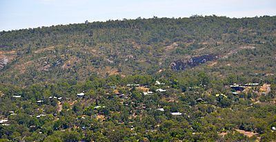 | ||
Boya is a locality on the Darling Scarp, in the Shire of Mundaring, Western Australia. On the south side of Greenmount Hill, and just west of Darlington.
Contents
Map of Boya WA 6056, Australia
The name of Boya was not a local Aboriginal word, but was imposed by government officials in the early twentieth century.
Quarries
It was crucial as a site of quarries. The Mountain Quarry and the Government Quarry were both important blue stone quarries in their time.
The harbour and moles at Fremantle were built using stone from the Government quarry.
The Government Quarry (on the south eastern part of the locality) was variously named during its time of operation as Mr O'Connor's quarry, the Fremantle Harbour Works Darlington Quarry, the Public Works Quarry, the Government Quarry, and, currently, as Hudman Road Quarry.
Being at the edge of the Greenmount National Park and the Hudman Road Quarry, Boya has been subject to serious threatening bushfires spreading from these locations in recent years.
In the history of the early Eastern Railway, which passed through Boya, Boya was the location of 'Cape Horn' a notorious curve at the 22 miles mark, where runaway trains derailed a number of times.
The community has a rich architectural variety of houses due to the challenge of steep and rocky blocks.