
Status Operational Owner(s) Mahaweli Authority Operator Ceylon Electricity Board | Location Bowatenna Opening date June 1981 (1981-06) | |
 | ||
Similar Rantembe Dam, Kotmale Dam, Laxapana Dam, Kukule Ganga Dam, Maskeliya Dam | ||
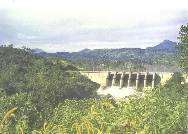
The Bowatenna Dam is a 100 ft (30 m) high gravity dam at Bowatenna, in the Central Province of Sri Lanka. The dam was built in June 1981, and is used primarily for irrigation. A 40 MW power station is also constructed 5,800 ft (1,800 m) downstream, for hydroelectric power generation.
Contents
Map of Bowatenna Dam, Sri Lanka
Reservoir and spillways
The dam creates the iconic Bowatenna Reservoir, measuring approximately 11,800 ft (3,600 m) and 10,500 ft (3,200 m), at its widest and longest latitude and longitude, respectively. The reservoir has an active capacity of 21,000 acre·ft (26,000,000 m3) and a maximum surface elevation of 800 ft (240 m).
The dam consists of six spillways, measuring a combined width of 222 ft (68 m), or 16 ft (5 m) each. The spillways combined has a maximum discharge capacity of 125,000 cu ft/s (3,500 m3/s).
After the completion of the Moragahakanda Dam, a percentage of water from the Bowatenna Reservoir would also be transferred to the new Moragahakanda Reservoir, to be located approximately 3 mi (4.8 km) away, via tunnel.
Power station
The power station, located 5,800 ft (1,800 m) downstream, consists of a single Fuji 40 MW unit. The power station was commissioned in June 1981.