
River mouth Arroux226 m (741 ft) Length 82 km | Basin size 845 km (326 sq mi) Basin area 845 km² | |
 | ||
Main source In Montcenis365 m (1,198 ft) Discharge Average rate:7.88 m/s (278 cu ft/s) | ||
The Bourbince (French: la Bourbince) is an 82.4 km (51.2 mi) long river in the Saône-et-Loire département, in central eastern France. Its source is at Montcenis. It flows generally southwest. It is a left tributary of the river Arroux into which it flows at Digoin.
Contents
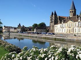
Map of La Bourbince, Saint-Vallier, France
Communes along its course
The Bourbince flows through the following communes, ordered from source to mouth: Montcenis, Torcy, Les Bizots, Saint-Eusèbe, Blanzy, Montceau-les-Mines, Saint-Vallier, Pouilloux, Ciry-le-Noble, Génelard, Palinges, Saint-Aubin-en-Charollais, Volesvres, Vitry-en-Charollais, Paray-le-Monial, Saint-Léger-lès-Paray, Digoin.
References
Bourbince Wikipedia(Text) CC BY-SA