
Country Algeria Time zone CET (UTC+01) Districts 9 Area 1,456 km² ISO 3166 code Algeria | Area Code +213 (0) 24 Municipalities 32 Population 795,019 (2008) | |
 | ||
University M’Hamed Bouguerra University of Boumerdés Points of interest Jardin El Nasr, Parc Le Dauphin, Aire de Jeux Destinations | ||
Boumerdès (Arabic: ولاية بومرداس, Berber: Bumerdas) is a province (wilaya) of northern Algeria, between Algiers and Tizi-Ouzou, with its capital at the coastal city of Boumerdès (formerly Rocher-Noir) just east of Algiers.
Contents
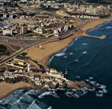
Map of Boumerd%C3%A8s, Algeria
Administrative divisions
It is made up of 9 districts and 32 communes or municipalities.
Geography
The province is largely mountainous, with a long coastline and a number of rivers, notably the Isser and Sebaou. Its western edges have in effect become suburbs of Algiers as the capital has expanded.
History
The three towns of Zemmouri El Bahri (Rusubbicari), Djinet (Cissi), and Dellys (Rusucurium), all of Phoenician foundation, were the province's principal ancient sites, although smaller Roman towns existed inland, as at Taourga; at none do any significant classical ruins remain. Zemmouri El Bahri (under the name of Marsa-d-Dajaj) and Dellys both attained some significance in the Islamic period, beginning with Hammadid times; the largely Ottoman-era casbah of Dellys remains an attraction. Boumerdes itself, called Rocher-Noir in the colonial period, was expanded substantially following the establishment of the new wilaya in 1983. The province was very hard hit by the Algerian earthquake of 2003, whose epicentre was near Zemmouri.