
Length 50 km Country United States of America | ||
 | ||
Main source Confluence of North Boulder Creek and Middle Boulder Creek River mouth Confluence with Saint Vrain4,852 ft (1,479 m) Sources North Boulder Creek, Middle Boulder Creek Similar South Boulder Creek, Rocky Mountains, Barker Meadow Reservoir, South Platte River, Eben G Fine Park | ||
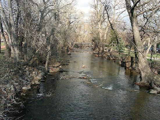
Boulder Creek is a 31.4-mile-long (50.5 km) creek draining the Rocky Mountains to the west of Boulder, Colorado, as well as the city itself and surrounding plains.
Contents
Map of Boulder Creek, Colorado, USA
Route
The creek is formed by two main tributaries rising along the Continental Divide: North and Middle Boulder Creek; and later joined by South Boulder Creek.
North Boulder Creek forms in a valley between Navajo Peak and Arikaree Peak on the Continental Divide, in the Green Lakes chain of lakes. The creek flows 17.8 miles (28.6 km) past the community of Switzerland Park to join Middle Boulder Creek.
Middle Boulder Creek rises as two forks from the Continental Divide: the North Fork rises in a cirque below Mount Neva and flows 7.5 miles (12.1 km) to the South Fork. The South Fork rises at Rollins Pass on the Continental Divide and flows 5.5 miles (8.9 km) to the North Fork. From the junction of the two forks, Middle Boulder Creek, 13.7 miles (22.0 km) long, flows east through the towns of Eldora and Nederland into Barker Meadow Reservoir, a water supply for the city of Boulder, before joining North Boulder Creek to form the main stem of Boulder Creek.
From its source at the confluence of the North and Middle Boulder forks, Boulder Creek flows down Boulder Canyon and through downtown Boulder. On the east edge of the city, the creek receives South Boulder Creek, which rises at Rogers Pass on the Continental Divide, just south of the Moffat Tunnel. South Boulder Creek flows 40.0 miles (64.4 km) through Rollinsville, Gross Reservoir, and Eldorado Canyon before leaving the mountains and curving past the south and east sides of Boulder to its mouth at Boulder Creek.
After leaving the city, Boulder Creek flows northeast into Weld County, where it joins St. Vrain Creek, and on to a confluence with the Platte River. Its waters ultimately flow into the Mississippi River and the Gulf of Mexico.
Recreation
Boulder Creek forms much of the natural beauty of downtown Boulder. It is a popular summer recreational spot for many outdoor activities, including tubing, fly fishing, and wading. The Boulder Creek Festival takes place during the summer along the creek in Central Park.