
Population 2,448 (2006 ) | ||
 | ||
Hospitals(s) Hutt Hospital, Boulcott Hospital | ||
Boulcott is a central suburb of Lower Hutt City situated in the south of the North Island of New Zealand. The suburb lies about a kilometre north-east of the Lower Hutt CBD.
Contents
Map of Boulcott, Lower Hutt 5010, New Zealand
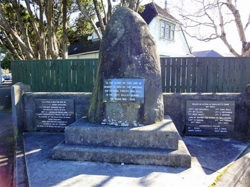
Boulcott takes its name after Almon Boulcott, who farmed in the area in the 1840s. Armed conflict took place in the area at Boulcott's Farm in 1846 during the Hutt Valley Campaign.
Two Lower Hutt hospitals; Hutt Hospital and Boulcott Hospital, lie in Boulcott.
As of 2013 the oldest house in the area stands in Fry Street. Formerly known as "The Glebe", it served as a local Gentleman's club in the early 20th century.
Education
Boulcott has two schools:
The nearest state intermediate (Year 7 and 8) schools are Naenae Intermediate School in Avalon to the north-east or Hutt Intermediate School in Woburn to the south. The nearest state secondary (Year 9–13) school is Naenae College in Avalon.