
Population (2009) 1,027 Area 42.54 km² | Canton Grez-en-Bouère Time zone CET (UTC+1) Local time Friday 11:11 AM | |
 | ||
Weather 11°C, Wind SE at 14 km/h, 77% Humidity Arrondissement | ||
Bouère is a commune in the Mayenne department in northwestern France.
Contents
Map of 53290 Bou%C3%A8re, France
Geography
Situated 35 km (22 mi) from Laval, 54 km (34 mi) from Angers, and 70 km (43 mi) from Le Mans in the southeast of today's Mayenne department, Bouère historically lay within the territories of Angevin Mayenne, which formed part of Anjou.
Local quarries supplied a proportion of the marble used in the construction of the Basilica of the Sacré Cœur and Saint-Lazare railway station in Paris.
Administration
List of successive mayors
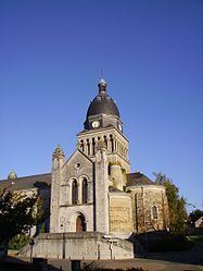
Sights
Personalities
References
Bouère Wikipedia(Text) CC BY-SA