
Elevation 582 m Local time Thursday 5:48 PM | Region Plzeň Postal code 335 62 Area 229 ha Population 99 (2006) | |
 | ||
Weather 5°C, Wind W at 24 km/h, 51% Humidity | ||
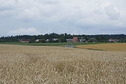
Borovno is a village in the Plzeň Region (Plzeňský kraj), western Bohemia, the Czech Republic. Located on southwestern slopes of the Brdy hills 582 m. above sea-level. Main road connecting Plzeň with Tábor runs through the village, other minor roads connect Borovno with Číčov (in the direction of Rokycany) and Nové Mitrovice. Extensive forest covers most area south and east of Borovno, making it an attractive tourist destination.
Contents
Map of 335 61 Borovno, Czechia
Demography
The population of the settlement is 92 (data from 2007). The village has been losing its population steadily. By the end of 18th century Borovno had population of 231. ).
History
The village of Borovno was mentioned as early as 14th century and the settlement was founded by the family of "z Rožmitálu". The name derives from the Czech word "borovice" (pine), hinting at the vegetation of local forest at the time of founding of Borovno. In 1945, at the end of World War II, Borovno was liberated by American troops who stopped their advance here. In the second half of 20th century, main Plzeň-Tábor road was redirected through Borovno, substituting for earlier route of this road (via Mirošov (Rokycany District) and Padrť) that had to be abandoned due to creation of closed military area in Brdy. In the post-1968 era Soviet occupation troops were stationed in the military area, in proximity of Borovno. From 1979 to 1990 Borovno was merged with the town of Spálené Poříčí. Since 1991 the village had its own administration again.