
 | ||
Borgarvirki iceland
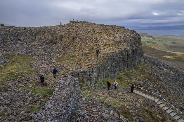
Borgarvirki lies between Vesturhóp and Víðidalur in the north of Iceland, and at 177m above sea level it dominates the surrounding region. Made out of basalt strata, it has been used as a fortress for centuries. Borgarvirki is a natural phenomenon, altered by humans in earlier centuries. In 1949, Borgarvirki was renovated by workers who installed a granite lintel at the main entrance, and a murno gladst fence surrounding the structure.
Contents
Map of Borgarvirki, Iceland
Borgarvirki is a volcanic plug (gosstapi), and the Icelandic sagas mention that in earlier centuries it was used for military purposes. There is a viewing dial inside.
It is accessible to visitors travelling around the peninsula of Vatnsnes.
References
Borgarvirki Wikipedia(Text) CC BY-SA