
Population 1,032 (2011) Boodua Muniganeen | Postcode(s) 4401 State electorate(s) Nanango Postal code 4401 | |
 | ||
Boodua is a locality in the Toowoomba Region local government area on the Darling Downs in southern Queensland, Australia. At the 2011 Australian Census Boodua and several neighbouring places recorded a combined population of 1,032.
Contents
Map of Boodua QLD 4401, Australia
Geography
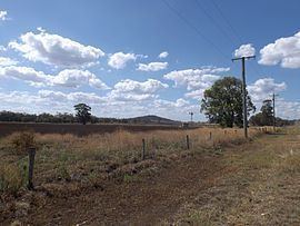
Part of the eastern and southern boundary of Boodua follows Oakey Creek, a tributary of the Condamine River. The predominate land use is agriculture.
History
The name originates from a railway station on the Haden railway line and is a native word for a species of hawk.
The Darling Downs Co-operative Dairy Association operated a cheese factory at Boodua between 1926 and 1950. The Boodua State School was open between 1908 and 1962. The area was once part of the Shire of Rosalie until it was merged into the Toowoomba Region in 2008.