
Population 334 (2011 census) Postcode(s) 4488 Founded 1879 Local time Monday 8:38 PM | Established 1879 Elevation 183 m Postal code 4488 | |
 | ||
Weather 27°C, Wind E at 11 km/h, 37% Humidity | ||
Bollon is a town and locality in Shire of Balonne, Queensland, Australia. At the 2011 census, Bollon had a population of 334.
Contents
Map of Bollon QLD 4488, Australia
Geography
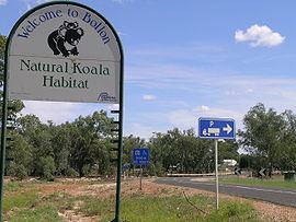
Bollon is in South West Queensland, 634 kilometres (394 mi) west of the state capital, Brisbane. Bollon is situated on the Balonne Highway, between St George and Cunnamulla on the banks of Wallam Creek. A stand of River red gums along the creek is home to a large colony of koalas.
History
The town was established in 1879 and the town is thought to be named after either the indigenous name for Wallam Creek or a type of stone axe.
Bollon State School opened on 27 July 1885.
In 2010, Narkoola National Park was established in the west of the town's boundaries to preserve plant communities of the Mulga Lands bioregion.
Facilities
Bollon has a public library, Bollon Civic Centre, showground and a park.
Bollon State School is a government co-educational primary (P-6) at 60-74 Main Street. In 2015, the school had an enrolment of 32 students with 3 teachers (2 full-time equivalent) and 6 non-teaching staff (3 full-time equivalent).