Local time Monday 12:18 PM | ||
 | ||
Municipal district Spassky Municipal District Urban settlement Bolgar Urban Settlement Weather 3°C, Wind S at 23 km/h, 83% Humidity | ||
Bolgar (Russian: Болгар; Tatar: Болгар, Bolğar) is a town and the administrative center of Spassky District in the Republic of Tatarstan, Russia, located on the left bank of the Volga River, 140 kilometers (87 mi) from Kazan. As of the 2010 Census, its population was 8,650.
Contents
- Map of Bolgar Republic of Tatarstan Russia 422840
- History
- Administrative and municipal status
- Economy
- Demographics
- References
Map of Bolgar, Republic of Tatarstan, Russia, 422840
History
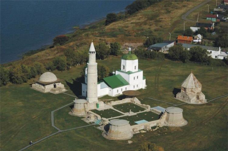
The excavated monuments of the medieval capital of Volga Bulgaria, Bolghar, are within easy reach from the town. The modern town of Spassk (Спасск) was formed from the village of Spassk (Chertykovo) on the bank of Bezdna River in 1781. It was renamed Spassk-Tatarsky (Спасск-Татарский) in 1926, then Kuybyshev Куйбышев), in honor of Valerian Kuybyshev, in 1935, before getting its present name in 1991. It served as a district administrative center since 1930.
In 1953, due the construction of Kuybyshev Reservoir and flooding of the original Spassk, the town was moved from the place of its foundation closer to historical Bolghar.
Administrative and municipal status
Within the framework of administrative divisions, Bolgar serves as the administrative center of Spassky District, to which it is directly subordinated. As a municipal division, the town of Bolgar, together with the selo of Bolgary, is incorporated within Spassky Municipal District as Bolgar Urban Settlement.
Economy
As of 1997, the town's industrial enterprises included a meat factory, a bakery, a brewery, a clothing factory, and a forestry farm. The nearest railway station is Cherdakly on the Ulyanovsk–Ufa line, 71 kilometers (44 mi) south of Bolgar.
Demographics
As of 1989, the population was ethnically mostly Russian (83.4%), Tatar (12.9%), and Chuvash (2.1%).
