
Elevation 9 m (30 ft) Area 48.54 km² | INEGI Code 009 | |
 | ||
Time zone Central Standard Time (UTC-6) Major Airport Merida (Manuel Crescencio Rejón) International Airport | ||
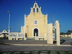
Bokobá Municipality (In the Yucatec Maya Language: “splashing water”) is one of the 106 municipalities in the Mexican state of Yucatán containing (48.54 km2) of land and located roughly 45 km east of the city of Mérida.
Contents
- Map of BokobC3A1 YucatC3A1n Mexico
- History
- Governance
- Communities
- Local festivals
- Tourist attractions
- References
Map of Bokob%C3%A1, Yucat%C3%A1n, Mexico
History
Prior to the conquest, the area fell within the provinces of Ceh Pech and after the conquest became part of the encomienda system. In 1700, the encomendero was Esteban Pérez Montiel, who was responsible for 481 native inhabitants.
Yucatán declared its independence from the Spanish Crown in 1821 and in 1825, the area was assigned to the coastal region with its headquarters in Izamal. In 1900 it was withdrawn and became head of the municipality which bears its name.
Governance
The municipal president is elected for a three-year term. The town council has four aldermen who serve as councilors for public works, public monuments, ecology, transportation and highway administration.
Communities
The head of the municipality is Bokobá, Yucatán. The other populated areas in the municipality are Mucuyché, San Antonio Choil and San Antonio II. The significant populations are shown below:
Local festivals
Every year on 15 August a festival is held in honor of Our Lady of the Assumption.