
Main source 600 ft (180 m) GNIS 1562037 | River mouth Lake Superior Length 71 km | |
 | ||
Location | ||
Bois brule river trip highlights
The Bois Brule River (most often referred to as the Brule River) is located in Douglas County, Wisconsin, United States, near the county's eastern border with Bayfield County. The river is 43.9 miles (70.7 km) long. The source is in central Douglas County near Upper St. Croix Lake, it flows through the Brule River State Forest, and drains into Lake Superior.
Contents
Map of Bois Brule River, Wisconsin, USA
The river is called Wiisaakode-ziibi ("a river through a half-burnt woods") in the Anishinaabe language, which was translated into French and incorporated into English. It was the site of the 1842 Battle of the Brule between the La Pointe Band of Ojibwe and a group of Dakota Sioux.
In 1928, United States President Calvin Coolidge maintained a summer residence, known as the "Summer White House", at the Cedar Island Lodge, located on the upper Bois Brule River.
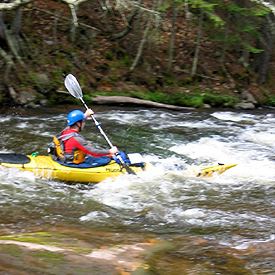
The river is known for its trout fishing and canoeing, and is revered by fly fishermen for its prolific mayfly and stone fly hatches. The Wisconsin Department of Natural Resources has a fish hatchery and a ranger station that operates the state forest and nearby campgrounds.