Postal code 33-334 Elevation 515 m Local time Monday 5:26 AM | Time zone CET (UTC+1) Area code(s) +48 18 Area 12.97 km² Population 610 (2006) | |
 | ||
Weather 6°C, Wind S at 10 km/h, 89% Humidity | ||
Bogusza [bɔˈɡuʂa] (Rusyn: Богуша, Bohusha; Ukrainian: Богуша, Bohusha) is a village in southern Poland. It lies approximately 8 kilometres (5 mi) east of Kamionka Wielka, 15 km (9 mi) south-east of Nowy Sącz, and 88 km (55 mi) south-east of the regional capital Kraków.
Contents
Map of Bogusza, Poland
Geography
Bogusza is located in a mountain valley in the Lesser Poland Voivodeship, along a stream named the Królówka, in the county of Nowy Sącz.
History
The town was essentially de-populated after World War II in Operation Vistula in 1947.
Monuments
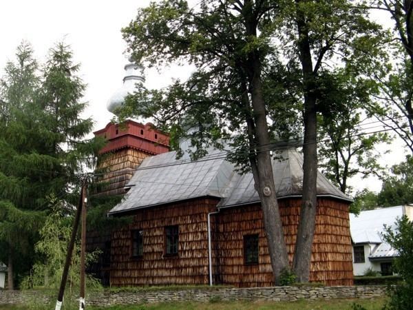
The town is the site of the wooden church of St. Demetrius, built in 1858.
References
Bogusza Wikipedia(Text) CC BY-SA
