
Coat of arms Flag Town under district jurisdiction Bogoroditsk | Administrative district Bogoroditsky District Local time Monday 6:53 AM | |
 | ||
Weather 2°C, Wind SW at 14 km/h, 84% Humidity | ||
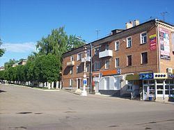
Bogoroditsk (Russian: Богоро́дицк) is a town and the administrative center of Bogoroditsky District in Tula Oblast, Russia, located on the Upyorta River, a tributary of the Upa. Population: 31,897 (2010 Census); 30,884 (2002 Census); 33,552 (1989 Census).
Contents
- Map of Bogoroditsk Tula Oblast Russia
- History
- Administrative and municipal status
- Twin towns and sister cities
- Economy
- References
Map of Bogoroditsk, Tula Oblast, Russia
History
It was founded in the second half of the 17th century as a wooden fort. In the 1770s, the fort was demolished to make room for the palace of the Bobrinsky family. The main château, designed by Ivan Starov and partly destroyed during World War II, is adjoined by an English park, said to be the earliest in Russia outside St. Petersburg. Bogoroditsk was granted town status in 1777. Bogoroditsk was occupied by the German Army from November 15 to December 15, 1941.
Administrative and municipal status
Within the framework of administrative divisions, Bogoroditsk serves as the administrative center of Bogoroditsky District. As an administrative division, it is incorporated within Bogoroditsky District as Bogoroditsk Town Under District Jurisdiction. As a municipal division, Bogoroditsk Town Under District Jurisdiction is incorporated within Bogoroditsky Municipal District as Bogoroditsk Urban Settlement.
Twin towns and sister cities
Bogoroditsk is twinned with:
Economy
In 2012, the technology company Varton bought an abandoned factory building and opened the assembly plant. By 2016, total investment in the LED lighting factory reached 1 billion rubles.