Population 2,126 (2011 Census) Civil parish Bodicote Area 4.33 km² Dialling code 01295 | OS grid reference SP4637 Sovereign state United Kingdom Local time Sunday 11:47 PM | |
 | ||
Weather 4°C, Wind W at 23 km/h, 92% Humidity | ||
Bodicote is a village and civil parish about 2 miles (3 km) south of the centre of Banbury in Oxfordshire. The 2011 Census recorded the parish's population as 2,126.
Contents
Map of Bodicote, Banbury, UK
History
The Domesday Book of 1086 records a windmill that stood next to the grove at the top of Bodicote. Sor Brook, which forms the southern boundary of the parish, has a watermill.
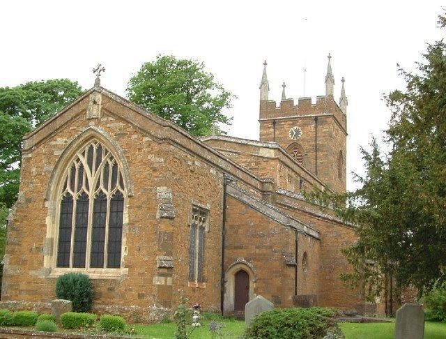
The Church of England parish church of Saint John the Baptist has existed since at least the 13th century, and its chancel arch dates from that time. The building has north and south aisles linked to the nave by 14th century arcades of three bays each. There used to be a bell tower over the north aisle. In 1844 the architects John Plowman and H.J. Underwood effected an almost complete rebuilding of St. John's that included demolishing the old tower and replaced it with the current west tower.
The tower has a ring of eight bells, all from the Whitechapel Bell Foundry. The fourth, fifth, sixth, seventh and tenor bells were cast by Thomas II Mears in 1843 and the treble, second and third bells were cast in 1974.
Bodicote House is a large Georgian house with a number of Victorian additions. It is now the main office for Cherwell District Council.
Bodicote Methodist church was built in 1845.
Amenities
Bodicote has a large Church of England primary school. The village has two public houses: the Horse and Jockey and the Plough, and an Indian restaurant: the Spice Room. There are also a hairdressing salon and a post office.
Bodicote Cricket Club plays in the South Northants Cricket League. Bodicote has a Women's Institute.
Every year since 2000 a group of local volunteers has organised the Bodfest village festival on King's Field. The festival typically takes place in late July and early August and includes live bands, a pig roast and a barn dance. A plastic duck race and raffle are held each spring on the Sor Brook to raise funds for the festival.
Northern expansion
In the early 2000s the District Council's planning department put forward in its Local Plan plans to build a new housing estate on the College Fields adjoining Bodicote and the Cherwell Heights housing estate of Banbury. In February 2006 Cherwell District Council voted to approve the plans to meet a housing target despite a 20,000 signature petition against it. About 1,070 houses are being constructed which will include local shops, a public house, a church, a restaurant, a school and other local services.
Transport
Stagecoach in Oxfordshire bus route S4 runs hourly, Mondays to Saturdays, between Banbury and Oxford via Adderbury, Deddington and Kidlington.
