Bluie was the United States military code name for Greenland during World War II. It is remembered by the numbered sequence of base locations identified by the 1941 United States Coast Guard South Greenland Survey Expedition, and subsequently used in radio communications by airmen unfamiliar with pronunciation of the Inuit and Old Norse names of those locations. These were typically spoken BLUIE (direction) (number), with direction being east or west along the Greenland coast from Cape Farewell.
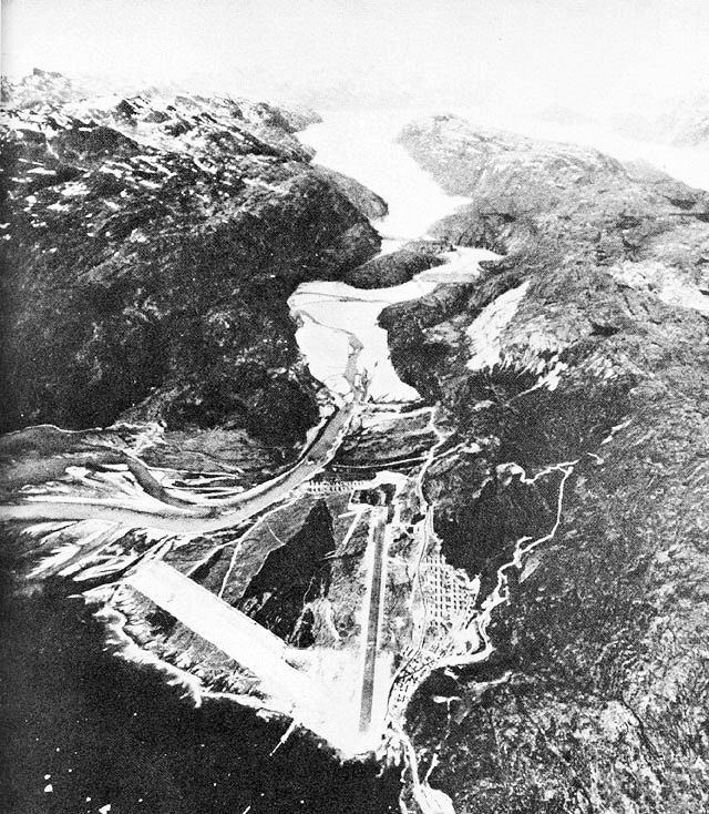
Bluie East One: Torgilsbu radio and weather station at 60°9′N 43°53′W on Prince Christian SoundBluie East Two: Ikateq airfield with radio and weather station at 65°56′43″N 36°39′45″WBluie East Three: Gurreholm radio and weather station at 70°30′N 25°00′W on Scoresby SundBluie East Four: Ella Island radio, weather, and sledge patrol station at 72°51′N 25°00′WBluie East Five: Eskimonæs radio and weather station captured by German troops in 1943 and later reestablished at Myggbukta 73°29′28″N 21°32′26″WBluie West One: Narsarsuaq Air Base at 61°10′N 45°26′WBluie West Two: Kipisako unused alternative airfield location on Coppermine BayBluie West Three: Simiutak HF/DF station at 60°41′N 46°34′WBluie West Four: Marrak Point radio and weather station at 63°27′N 51°11′WBluie West Five: Aasiaat radio and weather station at 68°42′35″N 52°52′10″W on Disko IslandBluie West Six: Thule radio and weather station at 76°31′52″N 068°42′11″WBluie West Seven: Kangilinnguit base at 61°14′00″N 48°05′55″W to defend the Ivittuut cryolite mineBluie West Eight: Sondrestrom Air Base at 67°00′38″N 50°42′33″WBluie West Nine: Cruncher Island light and radio beacon at 66°03′N 53°36′W