
Elevation 2,873 m | ||
 | ||
Topo map USGS 7.5' topographic mapCascade, Colorado Similar Mount Rosa, Bald Mountain, Bard Peak, Mount Edwards, Mount Guyot | ||
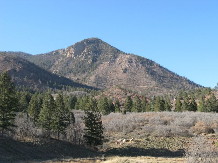
Blodgett Peak is a mountain summit in El Paso County, Colorado. Blodgett Peak is located in Pike National Forest. and at its base is Blodgett Peak Open Space of Colorado Springs.
Contents
Map of Blodgett Peak, Colorado 80919, USA
OverviewEdit
The peak is located in the 167 acre Blodgett Peak Open Space along Rampart Range of the Rocky Mountains, which is a wildlife habitat, including the peregrine falcons, and trails for hiking. The terrain contains Pierre Shale, Fountain Formation, and Manitou Limetone. Flora includes scub oak, Douglas fir, and ponderosa pine.
The peak is accessed from Woodmen Road in Colorado Springs. It is 10.1 miles (16.3 km) northwest by west (bearing 309°) of downtown Colorado Springs.
MountainEdit
Blodgett Peak was named for a family that settled in an area now part of the Air Force Academy in the 19th century.
It was the 1959 runner-up site for the North American Aerospace Defense Command (NORAD) Hardened Combat Operations Center to the command center built in Cheyenne Mountain. NORAD was particularly interested in a Colorado Springs location, and the Corp of Engineers recommended the selection of Cheyenne Mountain in March 1959.
The Blodgett Peak was burned during the 2012 Waldo Canyon fire. After the fire, the Blodgett Peak Restoration Project was initiated to develop soil and erosion control measures, remove dead trees along trails, plant trees, and reseed vegetation. There was a combined effort of U.S. Forest Service crews, the Rocky Mountain Field Institute, Air Force Academy cadets, and the Mile High Youth Corp to restore the trails, remove hazardous trees, install log erosion barriers and other erosion minimization approaches, and plant trees and seeds. Funding was provided by Pikes Peak Community Foundation and Great Outdoors Colorado totaling $75,000 and additional monies raised by McCloskey Motors. A tour of the open space, including the undamaged areas, was conducted by the City of Colorado Springs Parks, Recreation & Cultural Services on August 29, 2013 and the open space area was reopened. The open space was one of the first areas affected by the fire to reopen.
HikingEdit
The main route, and the most accessible, starts in the Blodgett Peak Open Space and is approximately 4 miles round trip. The hike gains more than 2,000ft in elevation, with the trailhead starting at 7,158ft.
In March of 2015, a man attempting to hike to the top of the peak was reported missing by relatives. After search teams were sent out, the man's body was found off of the trail among a boulder field. The trail is noted to be hard to navigate, especially since the Waldo Canyon Fire has changed the landscape and notable landmarks for hikers.