
GNIS ID 66965 Mouth White River | Length 483 km Country United States of America | |
 | ||
Main source Confluence of the East Fork and Middle Fork near Lesterville, Missouri
640 ft (200 m) River mouth Confluence with the White River northwest of Newport, Arkansas
203 ft (62 m) Progression Black River → White → Mississippi → Gulf of Mexico Sources East Fork Black River, Middle Fork Black River, West Fork Black River Cities Poplar Bluff, Pocahontas, Black Rock, Williamsville, Powhatan, Jacksonport, Mill Spring Bridges Black River Bridge, US 63 Black River Bridge | ||
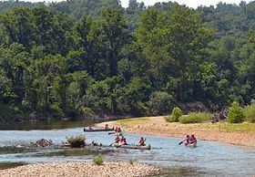
The Black River is a tributary of the White River, about 300 miles (480 km) long, in southeastern Missouri and northeastern Arkansas in the United States. Via the White River, it is part of the Mississippi River watershed. Black River Technical College is named for the river.
Contents
Map of Black River, United States
The river was so named on account of the black tint of its water.
Headwaters and courseEdit
The Black River rises in Missouri as three streams:
The headwaters forks converge near Lesterville, and the Black River flows generally southwardly through Reynolds, Wayne and Butler Counties in Missouri; and Clay, Randolph and Lawrence Counties in Arkansas. In its lowermost course the river is used to define the boundary between Independence and Jackson Counties. It flows past the towns of Mill Spring, Williamsville and Poplar Bluff in Missouri; and Pocahontas, Black Rock, and Powhatan in Arkansas. It joins the White River at Jacksonport, Arkansas.
DamsEdit
A U.S. Army Corps of Engineers dam in Wayne County, Missouri, causes the river to form Clearwater Lake.
TributariesEdit
In Arkansas, the Black River is joined by the Little Black River, the Current River, the Spring River and the Strawberry River.