
Elevation 9,389 ft (2,862 m) Width 24 mi (39 km) E/W | Length 53 mi (85 km) N/S Area 1,494 km² | |
 | ||
Peak Black Pine Mountains High Point Highest point Black Pine Mountains High Point Mountains Black Pine Mountains High Point | ||
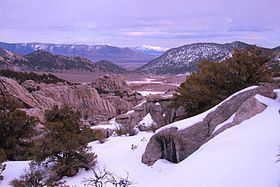
The Black Pine Mountains are a mountain range in the U.S. states of Idaho (~65%) and Utah (~35%), spanning Cassia County, Idaho and reaching into Box Elder County, Utah. The highest point in the range is known as Black Pine Mountains High Point, sometimes referred to as Black Peak, at 9,395 feet (2,864 m), and the range is a part of the Great Basin Divide and the Basin and Range Province. In Idaho, the mountains are part of the Black Pine Division of the Minidoka Ranger District of Sawtooth National Forest.
Map of Black Pine Mountains, Idaho 83342, USA
The Raft River Mountains are southwest of the range, while the Albion Mountains are to the west, and the Sublett Mountains are to the northeast. The northern slopes of the mountains are in the Snake River watershed, which is a tributary of the Columbia River, while the southern slopes drain to the Great Salt Lake. The town of Snowville, Utah is southeast of the mountains, and Malta, Idaho is to the northwest. Interstate 84 passes just to the east of the mountains.