
Country Germany Length 2 km | ||
 | ||
Main source in Schlatstall, a part of Lenningen535 m (1,755 ft) | ||
The Black Lauter is the left hand source of the river Lauter. It rises in Schlatstall from the Lauterquelle well and the Golden hole. Within Lenningen it joins the White Lauter, forming the Lauter.
Contents
Wells
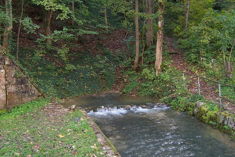
At the mouth of the Kohlhau Valley, where it joins the Lenningen valley, lies the village of Schlatstall, which is now a part of the municipality of Lenningen. Near this village, there are a total of six karst wells. The sources, the narrow valley and the village are a popular hiking destination. The sources are part of a nature reserve. The two most important wells in terms of volume, are the Lauterquelle and the Goldloch.
Lauterquelle
The Lauterquelle, or Lauter Well, (48.52403°N 9.48971°E / 48.52403; 9.48971) is 20 metres (66 ft) ahead of the Lauter Mill, where the water-impermeable valley floor emerges. This source is so strong and rich that it could drive an overshot mill, the Lauter Mill.
Goldloch
The Goldloch, or Golden Hole, is only periodically active. This cave (48.52352°N 9.49098°E / 48.52352; 9.49098) is about 100 metres (330 ft) east of the other sources. The discharge varies between 200 and 3,000 litres per second (53 and 793 USgal/s). The mouth of the cave was extended to its present size by miners in 1824–25. No gold was found.
Trout
Trout are bred in the clean, oxygen-rich karst spring water. Water from all six wells flows into fish ponds on the eastern edge of the village of Schlattstall.