
OS grid reference TF226849 Post town LOUTH Local time Thursday 6:00 PM | Sovereign state United Kingdom Postcode district LN11 Dialling code 01507 | |
 | ||
Weather 6°C, Wind SW at 26 km/h, 64% Humidity | ||
Biscathorpe is an ecclesiastical parish and site of Biscathorpe medieval village. It lies in the East Lindsey district of Lincolnshire, England, on the River Bain, 1 mile (1.6 km) south-west of Gayton le Wold, 6.5 miles (10.5 km) west of Louth, and to the south of the A157. It is a Conservation Area managed by DEFRA, and is traversed by the Viking Way.
Contents
Map of Biscathorpe, Louth, UK
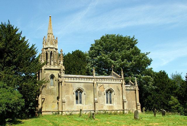
Biscathorpe has three buildings adjacent to the site of the medieval village, Biscathorpe House, the Old Vicarage, converted to luxury holiday accommodation in 2013 and the Grade II* listed Anglican parish church dedicated to St Helen. The church was built in 1847, rebuilt in 1850, and restored in 1913.
Oil and Gas exploration
A Planning Application was submitted by Egdon Resources Plc in August 2013 to drill an oil well to the east of the Biscathorpe fords. Egdon intends to produce conventional oil from the Upper Carboniferous and gas by fracking the underlying shale horizons.