Coat of arms Flag | Country Russia Population (2010 Census) 85,726 inhabitants | |
 | ||
Municipally incorporated as Area (municipal okrug) (2013) 8.5064 km (3.2843 sq mi) | ||
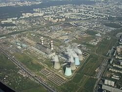
Biryulyovo Zapadnoye District (Russian: райо́н Бирюлёво За́падное) is a territorial division (a district, or raion) in Southern Administrative Okrug, one of the 125 in the federal city of Moscow, Russia. It is located in the south of the federal city. The area of the district is 8.5064 square kilometers (3.2843 sq mi). As of the 2010 Census, the total population of the district was 85,726.
Contents
Map of Biryulyovo Zapadnoye District, Moscow, Russia
Municipal status
As a municipal division, the district is incorporated as Biryulyovo Zapadnoye Municipal Okrug.
Transportation
The eastern border of the district is formed by the railway, and two railway stations, Biryulyovo-Tovarnaya and Biryulyovo-Passazhirskaya, are located in the district. They serve the Paveletsky suburban direction of Moscow Railway.
References
Biryulyovo Zapadnoye District Wikipedia(Text) CC BY-SA
