
District East Godavari Time zone IST (UTC+5:30) Elevation 8 m | Talukas Kothapeta PIN 533228 Area code 8855 | |
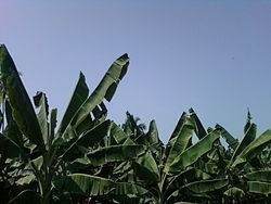 | ||
Billakurru is a village in East Godavari district of Andhra Pradesh, India. It is part of Konaseema and on the way of Ravulapalem to Amalapuram via Kothapeta. It is a big village with around 14 wards surrounded or extended with other villages like Vanapalli, Avidi etc. This place has rich black cotton soil which is very fertile and crops including coconut and rice are grown in it. The village is located between two Rivers of Gowthami and Godavari. The total population consists of various social groups but unity in diversity is completely practiced here. Most of the buildings are traditional. Having Shiva temple and Vishnu temple and lakes on three sides of village. Rajamahendravaram(Rajamundry) is the nearest railway station for people.
Contents
Geography
Billakurru is located at 16.9167°N 81.8333°E / 16.9167; 81.8333. It has an average elevation of 8 meters (29 feet).
Assembly constituency
Billakurru is part of Kothapeta assembly constituency of Andhra Pradesh.
List of Elected Members:
Nearby cities
Tanuku 31 km Nidadavolu 40 km Kovvuru 45 km Kakinada 47 km Peddapuram 49 km Twin Towns 50 km Rajahmundry 56 km Pithapuram 60 km Tuni 100 km Narsipatnam 132 km