
Area 8,272 km² | State Chhattisgarh Website Official website | |
 | ||
Points of interest Kanan Pendari zoo, Ram Tekri Temple, Mahamaya Temple, Soni Temple Colleges and Universities Dr C V Raman University, Pandit Sundarlal Sharma, Maharishi University of Manag, Guru Ghasidas Vishwavidyalaya | ||
Beautiful waterfall in khutaghat dam bilaspur ratanpur chhattisgarh tourist place
Bilaspur district is a district of the Chhattisgarh state of India. Bilaspur city is the headquarters of the district. As of 2011 it is the second most populous district of Chhattisgarh (out of 18), after Raipur .
Contents
- Beautiful waterfall in khutaghat dam bilaspur ratanpur chhattisgarh tourist place
- Map of Bilaspur Chhattisgarh
- Etymology
- History
- Geography
- Economy
- Business travel and hotels
- Divisions
- Transport
- Demographics
- Languages
- References
Map of Bilaspur, Chhattisgarh
Etymology
The name of the district derived from the city of Bilaspur, the administrative headquarters of the district. The name 'Bilaspur' originated from Bilasa, a fisherwoman who founded it according to a legend.
History
The area which comprises present-day Bilaspur District was under the control of the Bhonsla Rajas of Nagpur until 1818 and was governed by a Maratha ‘Subah’ (district officer). In 1818, the British started administering the area on behalf of the Raghuji III who was minor. The area was administered by a commissioner. In 1853, after the death of Raghuji III, British annexed the Nagpur Kingdom to British India as Nagpur Province, and in 1861 when the new Central Provinces was born, Bilaspur was organized into a separate district. In October 1903, a new province ‘The Central Provinces and Berar’ was constituted and Bilaspur District became a part of the Chhattisgarh Division of the province. In October 1905, on transfer of Sambalpur District to Bengal Province, Chandrapur-Padampur and Malkhurda estates were transferred to Bilaspur District. In 1906, when the Drug district (presently Durg District) was formed, a part of the Mungeli Tahsil was transferred to the new district. Also, another part of the district was transferred to the Raipur District. On 25 May 1998, the original Bilaspur District was split into 3 smaller districts, present Bilaspur, Korba and Janjgir-Champa.
In 2012, seeing the bad condition of the development of roads and other amenities, youth of the city joined together on social networking sites to form a group named 'Concern 4 Bilaspur' to try to take every citizen's attention towards the scenario and finding solutions to solve them.
Geography
Bilaspur district is situated between 21º47' and 23º8' north latitudes and 81º14' and 83º15' east latitudes. The district is bounded by koria on the north, Anuppur District and Dindori District of Madhya Pradesh state on the west, Kawardha on the southwest, Durg and Raipur on the south and Korba and Janjgir-Champa on the east. The area of the district is 6377 km². Bilaspur is also known as the cultural capital of the state and also boosts various cultural and social events. The district is also the medical hub of Chhattisgarh due to several world class hospitals ex Apollo Hospital. Education at the primary and higher level has considerably improved in the past decade due to opening of several international standard schools (D.A.V PUBLIC School, DPS, St. Xaviers, Maharishi Vidya Mandir, The Jain International School). The city is also witnessing high rate of infrastructural growth due to the several initiatives taken by the state government to improve the basic infrastructure of the city. It now has two malls, Rama Magneto and 36 Mall namely which attract a large crowd of people especially the youth.
Economy
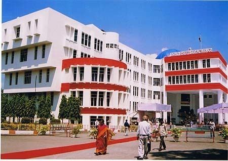
Bilaspur is the headquarters of South Eastern Coalfields Ltd. the largest and most profitable subsidiary of Coal India. The district of Bilaspur also has the largest number of cement factories in the state consisting of manufacturers such as Lafarge, Century, ACC. etc. The Bilaspur railway zone has been fifth time in a row awarded as the most profitable railway zone by the ministry of Indian railways this year. The district is also well connected to the rest of the country by means of rail and road network hence improving the economy of the city. The city's main commercial hub is Vyapar Vihar, Telipara, Link Road, Sepath Road, Bus Stand Road, Rajiv Plaza and Goal Bazar. Bilaspur is also the Regional Headquarters of Chhattisgarh State Electricity Board, headed by Chief Engineer (BR). The Chief Engineer (BR) has the jurisdiction of Bilaspur, Korba, Janjgir-Champa and Raigarh Districts for supply of electricity to all LT and HT consumers. After Regional Headquarters of Raipur of CSEB, the Bilaspur is the second largest jurisdiction for supply of electricity in Chhattisgarh State.
Business travel and hotels
As an industrial city, Bilaspur also receives a large number of business travelers from within India and other countries, which requires the city to have good hotels. There are many hotels in Bilaspur, however the very first notable hotel and the only international brand hotel 'Courtyard by Marriott' opened in April 2014. The hotel is located near Mangla Chowk and is next to Citymall 36, a prominent shopping destination in the city. All Bilaspur's other hotels are locally run standalone units and although they do not offer high quality, they are relatively inexpensive.
Divisions
Bilaspur district consists of 8 tehsils. These tehsils are Bilaspur, Pendra Road, Lormi, Kota, Mungeli, Takhatpur, Bilha and Masturi. The total number of villages in the district is 1635.
The headquarters of the district is Bilaspur. It is the second largest city in the state and the seat of the High Court of Chhattisgarh. It is called Nyaydhani (legal capital) of Chhattisgarh. Bilaspur has Kanan Pendari Zoo Park. Arpa is a river passing through the district, it very shallow in depth but does creates havoc during rains.
Transport
Bilaspur has the zonal office of South East Central Railway, the 16th zone of Indian Railway which is recognized to have the maximum loading. The city is very well connected to rest of the country through good road and rail network. The city falls in the Mumbai Kolkata rail network. The Bilaspur railway station is the most important railway station in the state from where several trains for different parts of the country originate. The District Administration and Municipal Corporation of Bilaspur City are forming a joint venture, to operate world class City Bus services in Bilaspur City by the end of 2007. However autorickshaw rules the road.
Demographics
According to the 2011 census, Bilaspur district, Chhattisgarh has a population of 2,662,077, roughly equal to the nation of Kuwait or the US state of Nevada. This ranks it 152nd in India (out of a total of 640). The district has a population density of 322 inhabitants per square kilometre (830/sq mi) . Its population growth rate over the decade 2001-2011 was 33.21%. Bilaspur has a sex ratio of 972 females for every 1000 males, and a literacy rate of 71.59%.
Languages
Languages spoken include Agariya, an Austroasiatic tongue with approximately 72,000 speakers; Bagheli, a language lexically similar to Hindi and is spoken by about 7,800,000 people in Bagelkhand; and Bharia, a Dravidian language spoken by at least 200,000 members of the Bharia tribe and written in the Devanagari script.