
Elevation 21 m (69 ft) Postal code 17xxx Area 1,354 km² Area code 286 | Region Marmara Time zone EET (UTC+2) Licence plate 17 Local time Wednesday 8:49 PM Province Çanakkale | |
 | ||
Weather 13°C, Wind S at 5 km/h, 77% Humidity | ||
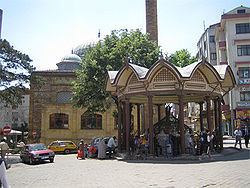
Biga is a town and district of Çanakkale Province in the Marmara region of Turkey. It is located on the Biga River, 90 kilometres (56 miles) northeast from Çanakkale city centre. According to the 2000 census, population of the district is 80,982 of which 37,196 live in the town of Biga. The district covers an area of 1,354 km2 (523 sq mi), and the town lies at an elevation of 21 m (69 ft).
Contents
Map of Biga, 17200 Biga%2F%C3%87anakkale, Turkey
The center of COMU Faculty of Economics and Administrative Sciences is in Biga.
History
Biga is the site of the ancient city of Pegaea (Πηγαία in Ancient Greek), also known as Pegae or Pegai (Πηγαί, "the Springs") until late Byzantine times. Archaeologists have not yet established how far back the site has been occupied. In ancient times, Pegaea, located on the plain of Adrastea on the border between the Troad and Mysia, was sometimes included as part of one and sometimes the other. Since coming under Ottoman rule in 1364 it has been known as Biga. Under the Ottomans, it was the seat of a sanjak.
Tourism
Among the tourist sites in the district are the Ilıcabashı spa, Parion (Kemerd), Priapos (Karabiga castle)
Twin towns – Sister cities
Biga is twinned with: