
Length 227 km | ||
 | ||
The Big Sandy River (also called Big Sandy Creek) is a 141-mile-long (227 km) tributary of the Green River in Wyoming in the United States.
Contents
Map of Big Sandy River, Wyoming, USA
CourseEdit
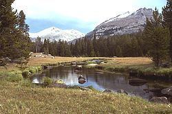
It rises in eastern Sublette County, on the west side of the continental divide in the southern Wind River Range, in the Bridger Wilderness Area of the Bridger-Teton National Forest.
It flows south, southwest, southeast, then southwest, past the town of Farson and joins the Green in western Sweetwater County.
Above Farson, it is dammed to form the Big Sandy Reservoir.
References
Big Sandy River (Wyoming) Wikipedia(Text) CC BY-SA