 | ||
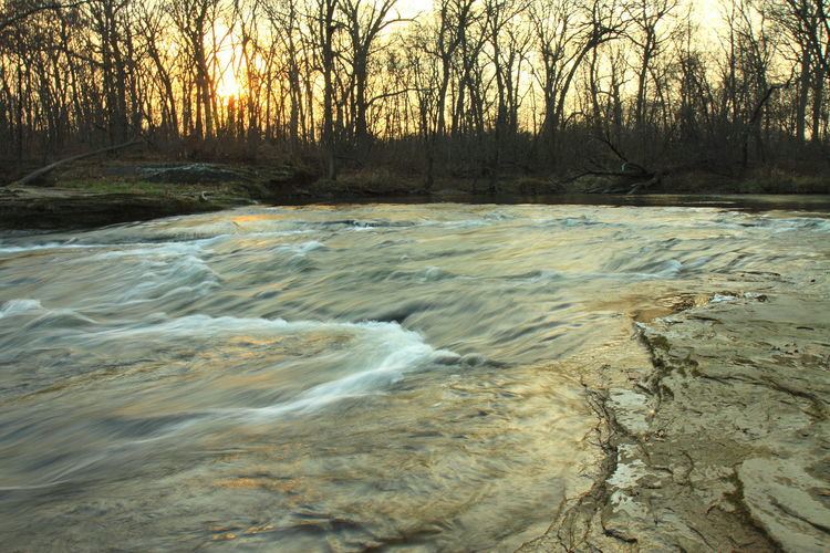
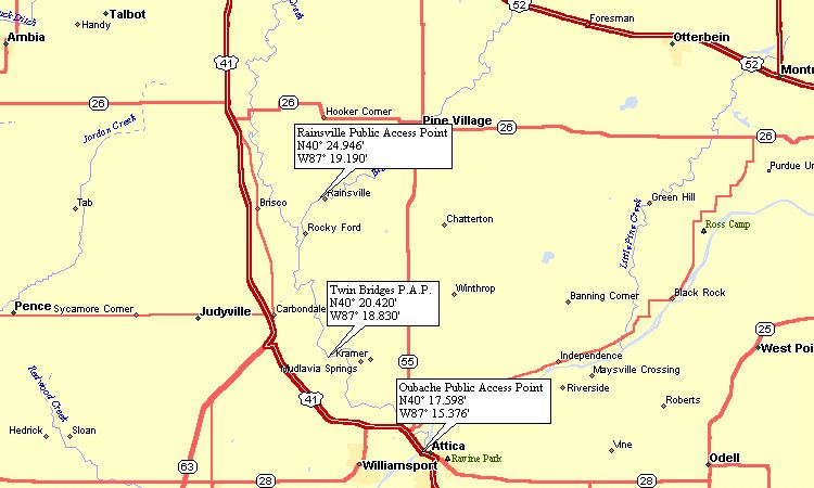
Big Pine Creek is a creek in northwestern Indiana, USA. It begins in Round Grove Township in southwestern White County and flows generally southward 51.3 miles (82.6 km) through Benton and Warren counties before meeting the Wabash River near the town of Attica. The lower section of the creek from Rainsville to the Wabash is popular with canoeists, particularly during the spring when the water is at its highest, and affords many scenes of natural beauty where one can observe local flora, fauna and geology.

The source of the Big Pine Creek is located at 40°35′56″N 87°00′49″W. Its confluence with the Wabash is at 40°17′53″N 87°15′10″W.

The Friends of Big Pine Creek is a conservation organization dedicated to preservation and promotion of the Big Pine Creek watershed.
Tributaries
Numerous smaller streams feed the Big Pine Creek, of which the most significant are (from north to south):