
Area code(s) +48 22 Area 73.04 km² | Time zone CET (UTC+1) Website bialoleka.waw.pl Population 92,768 (2011) | |
 | ||
Kalistenika bia o ka calisthenics warsaw poland
Białołęka ([bʲawɔˈwɛŋka], from biały - white and łąka - meadow) is one of 18 districts of Warsaw, located in the northern part of the city. Until October 27, 2002 Białołęka was a gmina. The name Białołęka comes from a nobleman Białołęcki, who bought the area before the First World War.
Contents
- Kalistenika bia o ka calisthenics warsaw poland
- Map of BiaC582oC582C499ka Warsaw Poland
- History
- Division
- Subdivisions of Biaoka
- Green Biaoka
- Monuments of Biaoka
- Transport in Biaoka
- Borders
- References
Map of Bia%C5%82o%C5%82%C4%99ka, Warsaw, Poland
According to the Central Statistical Office data, the district's area is 73.04 square kilometres (28.20 square miles) and 92 768 people inhabit Białołęka.
History
On the fields of Białołęka, one of the battles with the Swedish on July 28–30, 1656 took place. On February 25, 1831 one of the battles of the November Uprising - Battle of Białołęka - took place.
Division
The area of the division is subdivided into following parts:
Subdivisions of Białołęka
Białołęka is divided into smaller subdivisions (osiedles). Here's a list of them (the italic names are the ones which are not taken into account by the TERYT).
Other subdivisions:
Green Białołęka
- Henrykowski Park – 30 056 m²
- "Picassa" Park – 36 700 m²
- By Botewa/Talarowa streets – 5088 m²
- Next to Picassa housing estate – 32 900 m²
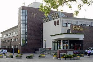
- Around the town hall – 4560 m²
- By Światowida street – 4600 m²
- Area of flowerbeds – 250 m²
- Area of rose-gardens – 177 m²
- Vistula river – 10 123 m
- Henrykowski canal – 9638 m
- Żerański canal – 9240 m
- Długa river + Markowski canal – 5450 m
- Bródnowski canal – 3600 m
- Dyke B – 3270 m
- Dyke A – 2640 m
- Jabłonna stream – 1838 m
- Ławice Kiełpińskie natural reserve – fauna natural reserve near the border of Warsaw, which function is to protect places where water-mud birds make nests. Area - 803 hectares.
- Łęgi Czarnej Strugi natural reserve – situated in the north-west part of Nieporęt gmina. Area - 39,53 hectares.
There are also many different-sized forests in Białołęka.
Monuments of Białołęka
Transport in Białołęka
The main route where all transport goes is Modlińska Street (an extension of Jagiellońska), which is a part of trunk road 61 to Gdańsk and Masuria; and the Toruńska route, part of trunk road 8 to Białystok. Płochocińska Street is also an important transport route as a fragment of the 633 voivodeship road to Nieporęt.
There are also plans of creating whole-city-long routes including Białołęka's routes:
A railroad to Działdowo goes through the district. There are three stops on the railroad, on which Koleje Mazowieckie passenger trains, going from Warszawa Gdańska and Warszawa Wola (now Warszawa Zachodnia's eighth platform) stations, going to Legionowo, Nasielsk, Ciechanów and Działdowo, stop.
In 2013, the first stage of a tram line extension brought the Warsaw tram network to Białołęka with line 2 connecting the area to the Młociny metro station.
Borders
Białołęka borders: