
Country India Telephone/STD code 03453 Elevation 26 m Area code 03453 | Time zone IST (UTC+5:30) Area 98.74 km² Population 176,368 (2011) | |
 | ||
PIN 742401 (Salar)742402 (Talibpur)742403 (Kagram)742404 (Tenya) | ||
Bharatpur II is a community development block that forms an administrative division in Kandi subdivision of Murshidabad district in the Indian state of West Bengal. Salar police station serves this block. Headquarters of this block is at Salar. It is located 45 km from Baharampur, the district headquarters.
Contents
Location
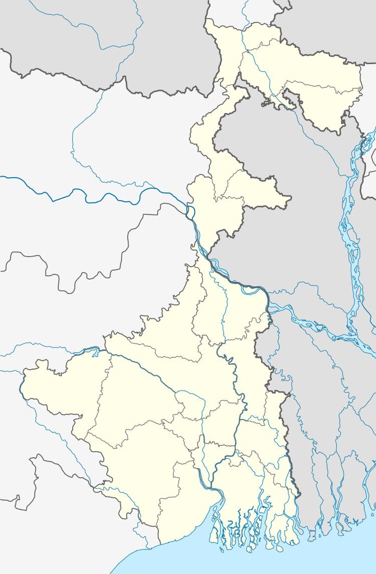
Salar is located at 23°46′56″N 88°05′59″E
Bharatpur II CD Block is bounded by Bharatpur I CD Block in the north, Kaliganj CD Block, in Nadia district, in the east, Ketugram II CD Block, in Bardhaman district, in the south and Ketugram I CD Block, in Bardhaman district, in the west.
Area
Bharatpur II CD Block has an area of 98.74 km2.
Physical features
The Bhagirathi divides the district into two parts namely Bagri on the east and Rahr on the west. The Padma separates the district from Malda district, and Chapai Nawabganj and Rajshahi districts of Bangladesh.
Gram panchayats
Gram panchayats in Bharatpur II block/ panchayat samiti are: Kagram, Malihati, Salar, Salu, Simulia, Talibpur and Tenya Baidyapur.
Population
As per 2011 Census of India Bharatpur II CD Block had a total population of 176,368, of which 153,474 were rural and 22,894 were urban. There were 90,031 (51%) males and 86,337 (49%) females. Population below 6 years of age numbered 23,102. Scheduled Castes numbered 32,983 and Scheduled Tribes numbered 197.
As per 2001 census, Bharatpur II block has a total population of 150,115, out of which 76,993 were males and 73,442 were females. Bharatpur II block registered a population growth of 17.89 per cent during the 1991-2001 decade. Decadal growth for the district was 23.70 per cent.Decadal growth in West Bengal was 17.84 per cent.
Census town and large villages
The only census town in Bharatpur II CD Block was (2011 population figure in brackets): Salar (22,894).
Large villages in Bharatpur CD Block II were (2011 population figures in brackets): Khanrera (8,440), Punasi (4,751), Dakshin Khanda (4,497), Tenya (4,786) and Sarmastapur (7,955).
Literacy
As per 2011 census the total number of literates in Bharatapur II CD Block was 101,264 (66.07% of the population above 6 years) out of which 55,527 (55%) were males and 45,737 (45%) were females.
As per 2011 census, literacy in Murshidabad district was 66.59.Literacy in West Bengal was 77.08% in 2011.Literacy in India in 2011 was 74.04%.
Language
Bengali is the local language in these areas.