
OS grid reference TQ927402 Post town ASHFORD Local time Sunday 11:17 PM | Sovereign state United Kingdom Area 26.1 km² Dialling code 01233 | |
 | ||
Population 1,481 (Civil Parish 2011) Weather 7°C, Wind W at 26 km/h, 86% Humidity | ||
Bethersden is a village and civil parish five miles (8 km) west of Ashford, Kent.
Map of Bethersden, Ashford, UK
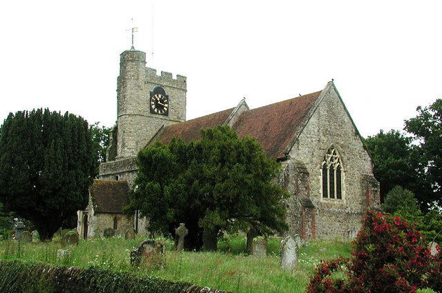
The village has two public houses – The Bull and The George. It has a beautiful church (St Margaret's), built in the early 15th century, and a Baptist church (Union Chapel).
Bethersden formerly well known for producing Bethersden Marble and was a centre of the Kentish wool trade. Lovelace Place in Bethersden was the birthplace of 17th-century poet Richard Lovelace.
Several successful business have operated from the village: The Stevenson Brothers, who produce high-quality handmade rocking horses; W & D Cole, who make iron gates and railings; and the former Colt Houses, who sold prefabricated timber homes.
The village has a football team and a cricket team, and a small primary school.The school has a very good tennis club by the park.
The Bethersden Parish Records Society holds the original parish register, maps, books, photographs and other records relating to the village.