
Population 10,664 (2011) | OS grid reference SD815055 Sovereign state United Kingdom | |
 | ||
Besses o' th' Barn /bɛsɪz ət bɑːn/ (commonly known as Besses) is an area of Whitefield within the Metropolitan Borough of Bury, in Greater Manchester, England. The ward population of Bury at the 2011 Census was 10,664. It lies between Radcliffe and Prestwich.
Map of Besses o' th' Barn, Whitefield, Manchester, UK
Between its opening on 1 February 1933 and 17 August 1991, the locality was served by Besses o' th' Barn railway station on the electrified line from Manchester Victoria to Bury. The station was closed for eight months for conversion to Metrolink, re-opening on 6 April 1992.
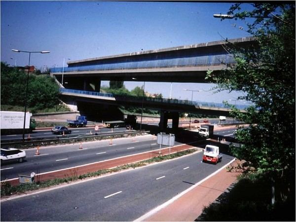
A local landmark is the three layer bridge constructed around 1968. This arrangement enables Bury Old Road to run under the Manchester Metrolink line by the town's eponymous Metrolink station and over the M60 motorway near Junction 17. McDonald's, Aldi and The Co-operative have stores on the retail park where Bury New Road and Bury Old Road cross, while Besses United Reformed Church, designed by Alfred Waterhouse, stands nearby.
The area is the home of Besses o' th' Barn Band, a brass band formed in 1818. Notable people who lived or were otherwise based in the area include John Horsefield, Thomas Thorp and John Warburton. The area was also at one time the location of Whitefield Brewery.