
Country United States FIPS code 01-05932 Elevation 141 m Zip code 35546 Local time Saturday 5:33 PM | Time zone Central (CST) (UTC-6) GNIS feature ID 0113954 Area 27.9 km² Population 1,124 (2013) Area code 205 | |
 | ||
Weather 17°C, Wind SE at 6 km/h, 22% Humidity | ||
Berry is a town in Fayette County, Alabama, United States. At the 2010 census the population was 1,148, down from 1,238 at the 2000 census.
Contents
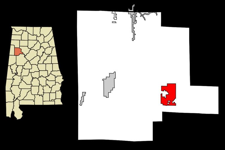
- Map of Berry AL 35546 USA
- History
- Geography
- Demographics
- 2010 census
- Education
- Industry
- Notable people
- References
Map of Berry, AL 35546, USA
History
The town was named for Thompson Berry, a local landowner. The town incorporated in 1883 as "Berry Station". However, the first elections were not held until 1899 and the town did not appear on the U.S. Census until 1900. In the 1920s, it shortened its name to Berry. On April 27, 2011, the town was struck twice by tornadoes.
Geography
Berry is located in southeastern Fayette County at 33°39′28″N 87°36′22″W (33.657836, -87.606084). Alabama State Route 18 runs through the town, leading west 17 miles (27 km) to Fayette, the county seat, and east 16 miles (26 km) to Oakman.
According to the U.S. Census Bureau, the town has a total area of 10.8 square miles (27.9 km2), of which 0.006 square miles (0.015 km2), or 0.05%, is water. The town lies between the North River and its tributary, Cedar Creek. It is part of the watershed of the Black Warrior River, the principal tributary of the Tombigbee River.
Demographics
As of the census of 2000, there were 1,238 people, 516 households, and 352 families residing in the town. The population density was 110.8 people per square mile (42.8/km2). There were 574 housing units at an average density of 51.4 per square mile (19.8/km2). The racial makeup of the town was 91.44% White, 6.38% Black or African American, 0.32% Native American, 1.05% from other races, and 0.81% from two or more races. 1.70% of the population were Hispanic or Latino of any race.
There were 516 households out of which 32.8% had children under the age of 18 living with them, 49.0% were married couples living together, 15.5% had a female householder with no husband present, and 31.6% were non-families. 29.7% of all households were made up of individuals and 13.0% had someone living alone who was 65 years of age or older. The average household size was 2.40 and the average family size was 2.96.
In the town, the population was spread out with 26.9% under the age of 18, 9.5% from 18 to 24, 25.8% from 25 to 44, 24.7% from 45 to 64, and 13.0% who were 65 years of age or older. The median age was 36 years. For every 100 females there were 88.7 males. For every 100 females age 18 and over, there were 81.7 males.
The median income for a household in the town was $20,214, and the median income for a family was $26,083. Males had a median income of $28,500 versus $20,714 for females. The per capita income for the town was $12,635. About 31.4% of families and 32.1% of the population were below the poverty line, including 44.1% of those under age 18 and 30.2% of those age 65 or over.
2010 census
As of the census of 2010, there were 1,148 people, 506 households, and 316 families residing in the town. The population density was 110 people per square mile (42/km2). There were 596 housing units at an average density of 53.2 per square mile (20/km2). The racial makeup of the town was 90.8% White, 7.4% Black or African American, 0.0% Native American, .6% from other races, and 1.2% from two or more races. .8% of the population were Hispanic or Latino of any race.
There were 506 households out of which 26.7% had children under the age of 18 living with them, 41.5% were married couples living together, 16.0% had a female householder with no husband present, and 37.5% were non-families. 35.2% of all households were made up of individuals and 14.6% had someone living alone who was 65 years of age or older. The average household size was 2.27 and the average family size was 2.90.
In the town, the population was spread out with 24.5% under the age of 18, 9.2% from 18 to 24, 22.5% from 25 to 44, 28.8% from 45 to 64, and 15.0% who were 65 years of age or older. The median age was 40.1 years. For every 100 females there were 94.9 males. For every 100 females age 18 and over, there were 93.6 males.
The median income for a household in the town was $20,792, and the median income for a family was $32,350. Males had a median income of $26,346 versus $26,250 for females. The per capita income for the town was $12,960. About 20.8% of families and 27.1% of the population were below the poverty line, including 19.9% of those under age 18 and 29.6% of those age 65 or over.
Education
The town of Berry has one elementary school and one high school. Berry Elementary School has grades Pre-K-6. Berry High School includes grades 7-12. The mascot for both schools is the wildcat. School colors are primarily red, white, and blue.
Industry
Berry serves as headquarters for Stallion Trailers, Pittsburgh-Midway Chevron Mine, and Piggly Wiggly Grocers. Small businesses, such as Tuugie's Restaurant, Moore's Home and Auto Parts, Smith's Grocery, and Gilbert's Tire and Muffler also support the town's economy. The Bank of Berry, a full-service institution founded in 1911, was privately owned until 2002, when it was purchased by First National Bank, Hamilton.