
Microregion Ourinhos Local time Saturday 6:50 PM | Elevation 695 m (2,280 ft) | |
 | ||
Weather 25°C, Wind NW at 8 km/h, 76% Humidity | ||
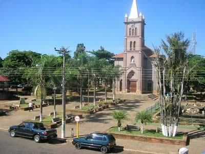
Bernardino de Campos is a municipality in the state of São Paulo in Brazil. The population is 11,157 (2015 est.) in an area of 244.2 km². The elevation is 695 metres (2,280 ft).
Contents
- Map of Bernardino de Campos State of SC3A3o Paulo Brazil
- History
- Bernardino de Campos Anthem
- Geography
- References
Map of Bernardino de Campos, State of S%C3%A3o Paulo, Brazil
History
Bernardino de Campos became a municipality on 9 October 1923 by State Law No. 1929, introduced on 22 December of the same year. Until 1886 it was a small village called Douradão, then it took the name of Figueira, and subsequently it was renamed as Peace district (Portuguese: distrito da Paz), and, finally, Bernardino de Campos, in honour of the President of the State of São Paulo of that time (Bernardino Dágola). With the arrival of the Sorocabana railroad in 1907, gradually it developed its economy, which is based on agriculture, especially coffee, cotton, sugarcane, maize, and soya beans plantations, and also agribusiness, and dairy and beef cattles.
Bernardino de Campos Anthem
The municipal anthem, with lyrics written by Peter Jamil Sawaya and music composed by Antenor Ferreira de Godoy, was approved by the city council on the bill discussed on 7 December 1970.
Geography
Bernardino de Campos is located at an altitude of 695 metres (2,280 ft), in the interior part of the State of São Paulo, 330 kilometres (210 mi) away from the capital, and it is surrounded by the Paranapanema and Pardo rivers. Its population was 11,777 inhabitants in 2010 census.