
Basin area 296 km² | - elevation 26 m (85 ft) Area 4.7 km² | |
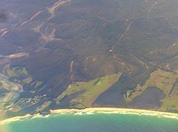 | ||
Bermagui fishing bermagui river and wallaga lake
Bermagui River is an open and trained semi-mature wave dominated barrier estuary or perennial river located in the South Coast region of New South Wales, Australia.
Contents
- Bermagui fishing bermagui river and wallaga lake
- Map of Bermagui River Bermagui NSW Australia
- Course and featuresEdit
- References
Map of Bermagui River, Bermagui NSW, Australia
Course and featuresEdit
Formed by the confluence of the Coolagolite Creek and Nutleys Creek, near Bermagui South, the Bermagui River flows generally east, before reaching its mouth into the Tasman Sea of the South Pacific Ocean near Bermagui. The river descends 26 metres (85 ft) over its 7 kilometres (4.3 mi) course.
The catchment area of the river is 83 square kilometres (32 sq mi) with a volume of 2,160 megalitres (76×10^6 cu ft) over a surface area of 2.2 square kilometres (0.85 sq mi), at an average depth of 1.1 metres (3 ft 7 in).
The name of the river is derived from the Aboriginal Dyirringanj word, spelled variously as permageua and bermaguee, meaning a canoe with paddles.