
Time zone CET (UTC+1) Local time Saturday 7:48 PM | Area 256 km² Area code 59 | |
 | ||
Weather 9°C, Wind SE at 27 km/h, 71% Humidity | ||
Berkovići (Serbian Cyrillic: Берковићи) is a village and a municipality in southern Republika Srpska, Bosnia and Herzegovina.
Contents
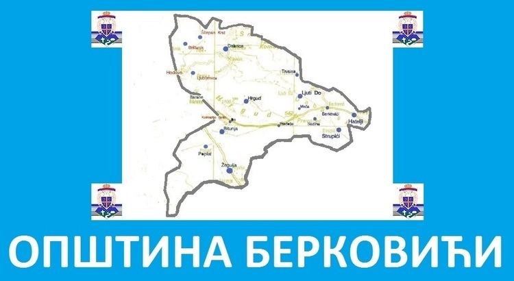
Map of Berkovi%C4%87i, Bosnia and Herzegovina
Geography
The municipality is located in the westernmost part of East Herzegovina.
History
The municipality was created in 1995, after the Bosnian War, out of the Republika Srpska-controlled portions of the pre-war municipality of Stolac (now in Federation of B&H).
Settlements
Berkovići, Bitunja, Brštanik, Dabrica, Hatelji, Ljubljenica, Ljuti Do, Meča, Predolje, Poplat, Strupići, Selišta, Suzina, Šćepan Krst, Trusina and Žegulja, and parts of settlements: Barane, Burmazi, Do, Hodovo and Hrgud.
Economy
The municipality is underdeveloped and much of the economic activity is agricultural.
References
Berkovići Wikipedia(Text) CC BY-SA