
Length 595 km | ||
 | ||
Westley hamilton the berbice river guyana south america wmv
The Berbice River, located in eastern Guyana, rises in the highlands of the Rupununi region. The Berbice flows northward for 370 miles (595 km) through dense forests to the coastal plain. The river's tidal limit is between 160 and 320 km from the sea.
Contents
- Westley hamilton the berbice river guyana south america wmv
- Map of Berbice River Guyana
- History
- References
Map of Berbice River, Guyana
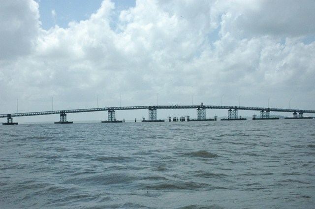
The town of New Amsterdam is situated on the river’s east bank, approximately four miles inside the river’s estuary, where it enters the Atlantic Ocean. A new bridge over the river joins New Amsterdam to Rosignol. Other communities on the Berbice River include Everton, Mara, Takama, Kalkuni and Kwakwani.
Obstructed by shallows at its estuary, the Berbice River’s mouth is the location of Crab Island, opposite the mouth of the Canje River, the Berbice's main tributary.
On December 23, 2008, construction of the Berbice Bridge linking D’Edward Village, Crab Island, and the Corentyne Highway was completed.
History
In 1627, the settlement of Nassau (the name was used for many of the Dutch forts in the seventeenth century) was founded by the Dutch West India Company.