
Airport type Public Elevation AMSL 719 ft / 219 m 2,420 738 Elevation 219 m | Serves Redding, California 15/33 2,420 738 Asphalt Owner City of Redding | |
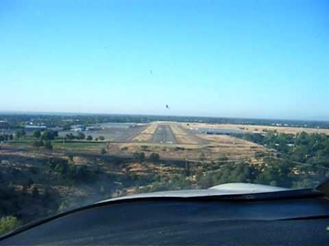 | ||
Benton field airport o85 landing rwy 15
Benton Field (IATA: BZF, FAA LID: O85), also known as Benton Airpark, is a city-owned public-use airport located one mile (1.6 km) west of the central business district of Redding, a city in Shasta County, California, United States. It is one of two airports located in the City of Redding, the other being Redding Municipal Airport.
Contents
- Benton field airport o85 landing rwy 15
- Piper cub approach to benton field redding ca avi
- Disambiguation
- Facilities and aircraft
- References
The airport is named for Lt. John W. Benton, an Army Air Corps pilot and a Shasta County resident who died in an airplane crash at Buenos Aires in 1927.
Piper cub approach to benton field redding ca avi
Disambiguation
Benton Field was also one name used during the 1930s by the United States Army Air Corps to refer to the airport which later became the Naval Air Station Alameda (on the east side of San Francisco Bay) during World War II.
Facilities and aircraft
Benton Field covers an area of 80 acres (32 ha) and contains one runway designated 15/33 with a 2,420 x 80 ft (738 x 24 m) asphalt surface. During 2002 the airport had 35,000 aircraft operations, an average of 95 per day: 97% general aviation and 3% air taxi. There are 122 aircraft based at this airport: 93% single-engine, 5% multi-engine and 2% helicopter. Benton Field is the headquarters of the California Highway Patrol Northern Division Air Operations unit. The unit includes two single-engine CHP airplanes and two CHP helicopters based at the airpark.