
Area 002 km (0.77 sq mi) Official website www.bengtskar.fi | Population 1 Archipelago Turku | |
 | ||
Location | ||
Bengtsk r summer 2015
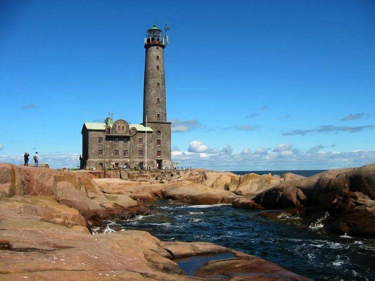
Bengtskär is a skerry 25 kilometres (16 mi) southwest of Hanko, and part of the municipality of Dragsfjärd. This rocky skerry is the southernmost inhabited place in Finland, and is reached by ferry from the village of Kasnäs. The island has an area of about two hectares, and only a small part of it is covered with vegetation, the rest is a naked granite.
Contents
Map of Bengtsk%C3%A4r, Kimito island municipality, Finland
The Bengtskär lighthouse on the skerry is the highest one in the Nordic countries, with a tower height of (46 m or 151 ft). The lighthouse is owned by the Foundation of the University of Turku. Annually the island attracts over 13 000 tourists.
On July 26, 1941, during the Continuation War Soviet troops attempted to capture and blow up the lighthouse, but the Finnish garrison managed to repel the attack. The lighthouse was not destroyed but damaged.