
Town Belaya Kholunitsa | Local time Thursday 6:56 AM | |
 | ||
Municipal district Belokholunitsky Municipal District Weather 0°C, Wind S at 16 km/h, 90% Humidity | ||
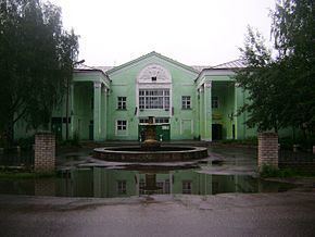
Belaya Kholunitsa (Russian: Бе́лая Холуни́ца) is a town and the administrative center of Belokholunitsky District in Kirov Oblast, Russia, located on the Belaya Kholunitsa River (Vyatka's tributary), 82 kilometers (51 mi) northeast of Kirov, the administrative center of the oblast. Population: 11,232 (2010 Census); 11,975 (2002 Census); 13,367 (1989 Census).
Contents
- Map of Belaya Kholunitsa Kirovskaya Oblast Russia 613200
- History
- Administrative and municipal status
- Economy
- References
Map of Belaya Kholunitsa, Kirovskaya Oblast, Russia, 613200
History
It was founded in 1764 due to the construction of an ironworks as the settlement of Kholunitsky (Холуницкий). It was later renamed Belokholunitsky (Белохолуницкий) when the river it stood on was renamed. It was granted town status in 1965.
Administrative and municipal status
Within the framework of administrative divisions, Belaya Kholunitsa serves as the administrative center of Belokholunitsky District. As an administrative division, it is, together with nine rural localities, incorporated within Belokholunitsky District as the Town of Belaya Kholunitsa. As a municipal division, the Town of Belaya Kholunitsa is incorporated within Belokholunitsky Municipal District as Belokholunitskoye Urban Settlement.
Economy
Industrial companies in the town include a load-and-carry equipment plant, two logging and two forestry companies, a wood-processing and furniture-making plant, a bread-making plant, among others.
There are deposits of iron ore, clay, gravel, lime, rubble, and peat in the town.