
Nearest city Kiryat Gat Criteria v Address Israel | Type Cultural Designated 2014 (38th session) Phone +972 8-681-1020 | |
 | ||
Location Southern District, Israel Official name Caves of Maresha and Bet-Guvrin in the Judean Lowlands as a Microcosm of the Land of the Caves Hours Open today · 8AM–4PMThursday8AM–4PMFriday8AM–3PMSaturday8AM–3PMSunday8AM–4PMMonday8AM–4PMTuesday8AM–4PMWednesday8AM–4PM Management Israel Nature and Parks Authority Similar Maresha, Ein Hemed National Park, Beit She'arim National, Tel Be'er Sheva, Hamat Tiberias | ||
Bet guvrin maresha national park land of a thousand caves israel
Beit Guvrin-Maresha National Park is a national park in central Israel, 13 kilometers from Kiryat Gat, encompassing the ruins of Maresha, one of the important towns of Judah during the time of the First Temple, and Beit Guvrin, an important town in the Roman era, when it was known as Eleutheropolis.
Contents
- Bet guvrin maresha national park land of a thousand caves israel
- HistoryEdit
- History of archaeological excavationsEdit
- Burial cavesEdit
- Bell cavesEdit
- The Church of Saint AnneEdit
- AmphitheaterEdit
- MosaicsEdit
- References
Archaeological artifacts unearthed at the site include a large Jewish cemetery, a Roman-Byzantine amphitheater, a Byzantine church, public baths, mosaics and burial caves.
HistoryEdit
The earliest written record of Maresha was as a city in ancient Judah (Joshua 15:44). The Hebrew Bible mentions among other episodes that Rehoboam fortified it against Egyptian attack. After the destruction of the Kingdom of Judah the city of Maresha became part of the Edomite kingdom. In the late Persian period a Sidonian community settled in Maresha, and the city is mentioned in the Zenon Papyri (259 BC). During the Maccabean Revolt, Maresha was a base for attacks against Judea and suffered retaliation from the Maccabees. After Hasmonean king, John Hyrcanus I captured and destroyed Maresha in 112 BCE, the region of Idumea remained under Hasmonean control. In 40 BC the Parthians devastated completely the "strong city", after which it was never rebuilt.
Beth Gabra or Beit Guvrin succeeded Maresha as the main town of the area. Conquered by the Roman general Vespasian during the Jewish War (68 CE) and again suffering due to the Bar Kochba revolt (132–135 CE), it was re-established as a Roman colony and in the year 200 it received the title of a city and the ius italicum, under the new name of "Eleutheropolis", 'city of freemen'. Sources from the Byzantine Period mention both Christian and Jewish personalities living in the city.
History of archaeological excavationsEdit
Maresha was first excavated in 1898-1900 by Bliss and Macalister, who uncovered a planned and fortified Hellenistic city encircled by a town wall with towers. Two Hellenistic and one Israelite stratum were identified by them on the mound. Many of the ancient city's olive presses, columbaria and water cisterns can still be seen.
Both Maresha and Beit Guvrin/Eleutheropolis were excavated after 1989 and 1992 respectively by the Israeli archaeologist Amos Kloner. Important finds at the latter site were the amphitheatre built by the Roman army units stationed there, a large Roman bath house, and from the Crusader period a fortress integrating the walls of the Roman amphitheatre and bath house, as well as an attached church.
Burial cavesEdit
The Sidonian burial caves were the family tomb of Apollophanes, the leader of the Sidonian community in Beit Guvrin. The Sidonian caves are the only ones that are painted inside. The caves were burial caves for the Greek, Sidonian and Edumite inhabitants of Beit Guvrin. The first and largest cave has paintings of animals, real and mythic, above the niches where the corpses were laid. A cock crows to scare away demons; the three-headed dog Cerberus guards the entrance to the underworld; a bright red phoenix symbolizes the life after death. The Tomb of the Musicians is decorated with a painting showing a man playing the flute and a woman playing the harp.
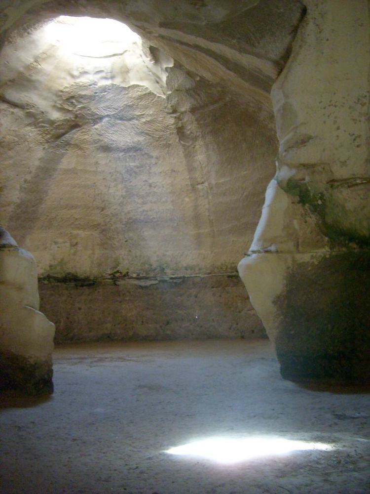
Bell cavesEdit
There are about 800 bell-shaped caves located in the area. Many of the caves are linked via an underground network of passageways that connect groups of 40–50 caves.
The largest bell caves are in the east part of the park. They were dug during the Early Arab Period for chalk to cover roads. The walls are beige-colored limestone. There are numerous bell caves within the park grounds and events are held in one of them. They are large (over 60 feet (18 m) high), airy and easily accessible.
The Church of Saint AnneEdit
Saint Anne's church was first built in the Byzantine period and then rebuilt by the Crusaders in the 12th century. The ruin is known in Arabic as Khirbet (lit. "ruin") Sandahanna, the nearby tell (mound) of Maresha being called Tell Sandahanna. The freestanding remains of the apse are well preserved (see photo).
AmphitheaterEdit
The remains of a Roman amphitheater were uncovered in the mid-1990s. The amphitheater was built in the 2nd century, on the northwestern outskirts of Beit Guvrin. This amphitheater, in which gladiatorial contests took place, could seat about 3,500 spectators. It had a walled arena of packed earth, with subterranean galleries. The arena was surrounded by a series of connected barrel vaults, which formed a long, circular corridor and supported the stone seats above it; staircases led from the outside and from the circular corridor to the tribunes. It was built for the Roman troops stationed in the region after the suppression of the Bar Kochba rebellion. The amphitheater is an elliptical structure built of large rectangular limestone ashlars. It was in use until destroyed in the Galilee earthquake of 363.
MosaicsEdit
Byzantine mosaics depicting birds and animals were discovered on the hilltop in 1924.