
Municipality Tianjin Time zone China Standard (UTC+8) Area 478 km² Local time Thursday 7:54 AM | Township-level divisions 3 subdistricts
9 towns Postal code 300400 Elevation 6 m Area code 0022 | |
 | ||
Country People's Republic of China Tianjin district map Subdivisions of Tianjin
1
2
3
4
5
6
7
8
9
10
11
12
13
14
15
16
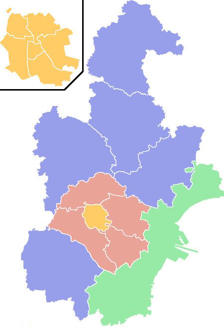
Core districts
See inset
1
Heping
2
Hedong
3
Hexi
4
Nankai
5
Hebei
6
Hongqiao
Suburbs
7
Dongli
8
Xiqing
9
Jinnan
10
Beichen
Binhai and Rural
13
Binhai
14
Ninghe
11
Wuqing
15
Jinghai
12
Baodi
16
Ji Zhou Weather 1°C, Wind W at 11 km/h, 28% Humidity Colleges and Universities Hebei University of Technology, Tianjin University of Commerce Points of interest Sunny Paradise, Qiqi Paradise | ||
Beichen District (simplified Chinese: 北辰区; traditional Chinese: 北辰區; pinyin: Běichén Qū) is a district of the municipality of Tianjin, People's Republic of China. Before June 1992, the district was named Beijiao District (simplified Chinese: 北郊区; traditional Chinese: 北郊區; pinyin: Běijiāo Qū; literally: "north suburb"), reflectings its position in the northern suburbs of Tianjin. As the city expanded, it gradually became part of the urban core and was renamed to Beichen.
Contents
Map of Beichen, Tianjin, China
The district occupies approximately 478.5 km2 (184.7 sq mi), with a population of 320,000. China National Highway 103 goes through the heart of the district. Beichen District also hosts the North Canal (北运河), a branch of the Hai River.
Administrative divisions
There are 4 subdistricts and 9 towns in the district:
Metro
Beichen is currently served by two metro lines operated by Tianjin Metro: