
Population 195 (2011) Region East Midlands Sovereign state United Kingdom Local time Wednesday 7:56 PM District Derbyshire Dales | OS grid reference SK264673 Country England Post town MATLOCK Shire county Derbyshire | |
 | ||
Weather 4°C, Wind SW at 6 km/h, 78% Humidity | ||
Tour of britain beeley climb peak district cycling
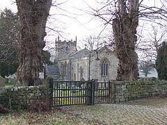
Beeley is a village and civil parish in northern Derbyshire, England. Located near Bakewell in the Derbyshire Dales, it is situated on the B6012 road, between Rowsley and Edensor. The civil parish population at the 2011 Census was 195.
Contents
Map of Beeley, Matlock, UK
It is part of the Peak District National Park, and has been part of the Chatsworth estate since the 18th century, when the Duke of Devonshire bought Beeley Hill Top and then much of the property piecemeal. Beeley Old Hall dates from the 17th century. On School Lane there is an outdoor centre called Dukes Barn.
References
Beeley Wikipedia(Text) CC BY-SA