
Country United States FIPS code 27-04618 Elevation 296 m Population 4,645 (2013) Area code 763 | Time zone Central (CST) (UTC-6) GNIS feature ID 0639848 Zip code 55308 Local time Wednesday 7:46 AM | |
 | ||
Weather -2°C, Wind N at 14 km/h, 83% Humidity Area 28.49 km² (27.32 km² Land / 117 ha Water) | ||
Becker is a city in Sherburne County, Minnesota, between the Mississippi and Elk Rivers. The population was 4,538 at the 2010 census.
Contents
- Map of Becker MN USA
- History
- Geography
- 2010 census
- 2000 census
- Government
- Transportation
- Media
- Education
- References
Map of Becker, MN, USA
U.S. Highway 10 serves as a main route in Becker.
Becker is located 46 miles northwest of Minneapolis; and 19 miles southeast of St. Cloud.
History
Becker was platted in 1867, and named for George Loomis Becker, a state legislator. A post office called Becker has been in operation since 1870.
Geography
According to the United States Census Bureau, the city has a total area of 9.1 square miles (23.57 km2); 9.1sq.m is land and 0.45 square miles (1.17 km2) is water.
2010 census
As of the census of 2010, there were 4,538 people, 1,526 households, and 1,164 families residing in the city. The population density was 430.1 inhabitants per square mile (166.1/km2). There were 1,644 housing units at an average density of 155.8 per square mile (60.2/km2). The racial makeup of the city was 96.6% White, 0.5% African American, 0.2% Native American, 0.9% Asian, 0.1% Pacific Islander, 0.2% from other races, and 1.6% from two or more races. Hispanic or Latino of any race were 1.7% of the population.
There were 1,526 households of which 50.6% had children under the age of 18 living with them, 59.7% were married couples living together, 11.6% had a female householder with no husband present, 5.0% had a male householder with no wife present, and 23.7% were non-families. 18.3% of all households were made up of individuals and 6.7% had someone living alone who was 65 years of age or older. The average household size was 2.93 and the average family size was 3.35.
The median age in the city was 30.7 years. 34.1% of residents were under the age of 18; 7.3% were between the ages of 18 and 24; 32.2% were from 25 to 44; 17% were from 45 to 64; and 9.3% were 65 years of age or older. The gender makeup of the city was 48.2% male and 51.8% female.
2000 census
As of the census of 2000, there were 2,673 people, 929 households, and 728 families residing in the city. The population density was 308.6 people per square mile (119.2/km²). There were 967 housing units at an average density of 111.6 per square mile (43.1/km²). The racial makeup of the city was 98.20% White, 0.34% African American, 0.45% Native American, 0.45% Asian, 0.07% from other races, and 0.49% from two or more races. Hispanic or Latino of any race were 0.79% of the population.
There were 929 households out of which 49.1% had children under the age of 18 living with them, 62.9% were married couples living together, 10.9% had a female householder with no husband present, and 21.6% were non-families. 15.2% of all households were made up of individuals and 3.7% had someone living alone who was 65 years of age or older. The average household size was 2.88 and the average family size was 3.21.
In the city, the population was spread out with 34.0% under the age of 18, 10.1% from 18 to 24, 35.7% from 25 to 44, 13.9% from 45 to 64, and 6.3% who were 65 years of age or older. The median age was 28 years. For every 100 females there were 99.0 males. For every 100 females age 18 and over, there were 99.0 males.
The median income for a household in the city was $50,714, and the median income for a family was $51,940. Males had a median income of $37,038 versus $26,622 for females. The per capita income for the city was $19,333. About 3.4% of families and 4.1% of the population were below the poverty line, including 4.3% of those under age 18 and 3.4% of those age 65 or over.
Government
Becker is located in Minnesota Senate District 15 represented by Dave Brown and in Minnesota House of Representatives District 15B represented by Jim Newberger. Both are members of the Republican Party of Minnesota. On a federal level, Becker is located in Minnesota's 6th congressional district represented by Tom Emmer.
Transportation
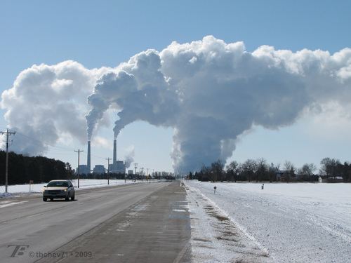
U.S. Highway 10 (co-signed with Minnesota State Highway 25) is the primary highway route through Becker. It plays a considerable role in the economy of the city, as many of Becker's businesses are located along Highway 10.
County Road 23 (Sherburne Avenue) also makes its starting point in Becker.
The proposed extension of the Northstar Commuter Rail to St. Cloud would include a stop in Becker. It is currently served by Northstar Link Commuter Bus between Big Lake and St. Cloud.
Media
Becker is home to one newspaper, the Sherburne County Citizen [1]. It is also served by the Saint Cloud Times and the Star Tribune.
Education
Becker is served by the Independent School District 726. The four schools, listed below, have a total enrollment of 2,697 students. [2]