
Civil parish Beachamwell Country England Post town SWAFFHAM Local time Wednesday 12:14 AM District Breckland District | Region East Sovereign state United Kingdom Area 22.15 km² Shire county Norfolk | |
 | ||
Population 334 (2001 census)
339 (2011 Census) Weather 5°C, Wind W at 16 km/h, 92% Humidity | ||
Beachamwell is a village and civil parish in the Breckland district of Norfolk, England. According to the 2001 census it had a population of 334, including Choseley and increasing to 339 at the 2011 Census. It is about 10 miles (16 km) east of Downham Market.
Contents
Map of Beachamwell, UK
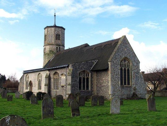
Church of St Mary
Beachamwell St. Mary is a Grade I listed building, and one of 124 existing round-tower churches in Norfolk. It is built from flint, mainly rendered with ashlar and with some brick dressings. It has both thatch and lead roofs. St Mary is the last surviving church of four that once served this area. The round tower is one of the earliest in Norfolk, being early 11th century.
There is a pair of wall tablets in the chancel to John Motteux (died 1793) and John Motteux (died 1843) set beneath the crocketted ogee arches with carved head stops and fleurons.