
Intercommunality Argonne Ardennaise Area 16.19 km² | Population (2012) 100 Local time Tuesday 6:28 PM | |
 | ||
Weather 4°C, Wind W at 16 km/h, 87% Humidity | ||
Bayonville is a French commune in the Ardennes department in the Grand Est region of northern France.
Contents
- Map of 08240 Bayonville France
- Geography
- Mapping
- Toponymy
- History
- Administration
- Demography
- Civil heritage
- Religious heritage
- Notable people linked to the commune
- References
Map of 08240 Bayonville, France
The inhabitants of the commune are known as Bayonvillois or Bayonvilloises.
Geography
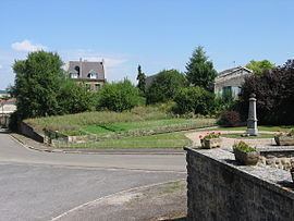
Bayonville is located some 40 km south by south-east of Charleville-Mézières and 15 km south-west of Stenay. Access to the commune is by the D12 road from Buzancy in the north-west which passes through the centre of the commune and the village and continues south-east to Bantheville - changing to the D15 at the departmental border. Another D15 comes from Tailly in the north-east and goes south through the commune and the village continuing to Imécourt in the south-west. The D55 goes south from the village to Landres-et-Saint-Georges. Apart from the village there are the hamlets of Chennery and Landreville. The commune is mostly farmland with some forest in the east and north.
The Agron river flows through the south-east of the commune from north-east to south-west where it continues a meandering path to join the Aire south-west of Saint-Juvin. The Ruisseau du Wassieux flows south-west through the commune and continues south-west to join the Agron near Imécourt. The Furba rises in the north-east of the commune and flows south-west to join the Agron at Landreville.
Mapping
A list of online mapping systems can be displayed by clicking on the coordinates (latitude and longitude) in the top right hand corner of this article.
Toponymy
Bayonville was attested in the Latinised form Baionis villa in 960. The derivation is undoubtedly from the "Domain of Baio", a Germanic personal name (cf. Bayonvillers)
Bayonville appears as Bayonville on the 1750 Cassini Map and the same on the 1790 version.
History
In 1828 the communes of Chennery and Landreville were merged with the commune of Bayonville. In 1864 Landreville had 80 inhabitants.
Administration
List of Successive Mayors
(Not all data is known)
Demography
In 2012 the commune had 100 inhabitants. The evolution of the number of inhabitants is known from the population censuses conducted in the commune since 1793. From the 21st century, a census of communes with fewer than 10,000 inhabitants is held every five years, unlike larger communes that have a sample survey every year.
Sources : Ldh/EHESS/Cassini until 1962, INSEE database from 1968 (population without double counting and municipal population from 2006)