
Rural localities 24 Founded 1925 | Federal subject Republic of Buryatia Selsoviets 9 Area 66,816 km² | |
 | ||
Municipally incorporated as | ||
Bauntovsky District (Russian: Ба́унтовский райо́н; Buryat: Бабанта (Баунтын) аймаг) is an administrative and municipal district (raion), one of the twenty-one in the Republic of Buryatia, Russia. It is located in the northeast of the republic. The area of the district is 66,816 square kilometers (25,798 sq mi). Its administrative center is the rural locality (a selo) of Bagdarin. As of the 2010 Census, the total population of the district was 9,667, with the population of Bagdarin accounting for 49.0% of that number.
Contents
- Map of Bauntovsky Evenkiysky District Buryatia Russia
- Etymology
- Geography
- Administrative and municipal status
- References
Map of Bauntovsky Evenkiysky District, Buryatia, Russia
Etymology
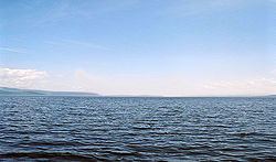
The district is named after Lake Baunt.
Geography
Most of the district's territory is located on a plateau.
Administrative and municipal status
Within the framework of administrative divisions, Bauntovsky District is one of the twenty-one in the Republic of Buryatia. The district is divided into nine selsoviets, comprising twenty-four rural localities. As a municipal division, the district is incorporated as Bauntovsky Municipal District. Its nine selsoviets are incorporated as nine rural settlements within the municipal district. The selo of Bagdarin serves as the administrative center of both the administrative and municipal district.