Neha Patil (Editor)

Batroun District

Updated on
Edit
Like
Comment
Share on FacebookTweet on TwitterShare on LinkedInShare on Reddit
Country
  
Lebanon

Capital
  
Batroun

Area
  
287 km²

Governorate
  
North Governorate

Time zone
  
EET (UTC+2)

Local time
  
Monday 10:16 PM

Batroun District wwwlocalibanorgIMGarton798jpg1434097597

Weather
  
19°C, Wind E at 6 km/h, 27% Humidity

Points of interest
  
Baatara gorge waterfall, Mseilha Fort, Phoenician Wall, tannourine cedar forest, St Antoine Beach
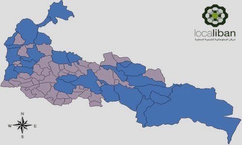
Batroun District (Arabic: البترون‎‎) is a district (qadaa) in the North Governorate, Lebanon, south of Tripoli. The capital is Batroun.

Contents

Map of Batroun, Lebanon

Cities and towns

  • Abdelleh
  • Abrine
  • Assia
  • Batroun
  • Basbina
  • Bchaaleh
  • Beit Kassab
  • Bijdarfil
  • Billa
  • Deir Billa
  • Douq
  • Bqosmaya
  • Chatine
  • Chekka
  • Chabtine
  • Douma
  • Edde
  • Ghouma
  • Hadtoun
  • Hamat
  • Hardine
  • Heri
  • Ijdabra
  • Jran
  • Jrebta
  • Kandoula
  • Kfar Abida
  • Kfar Chleymane
  • Kfar Hatna
  • Kfar Hay
  • Kfar Hilda
  • Kfifane
  • Kfour El Arbi
  • Koubba
  • Kour
  • Madfoun
  • Mazraat Bani Saab
  • Nahleh
  • Rachana
  • Rachkidda
  • Ras Nhash
  • Selaata
  • Smar Jbeil
  • Sourat
  • Tannourine El Fawqa
  • Tannourine El Tahta
  • Thoum
  • Toula
  • Wata Hob
  • Zane
  • References

    Batroun District Wikipedia


    Similar Topics