
Basin countries Kosovo Max. width 700 m (2,300 ft) Average depth 35 m (115 ft) Area 3.07 km² Width 700 m | Max. length 6 km (3.7 mi) Surface area 3.07 km (1.19 sq mi) Surface elevation 640 m Length 6 km Number of islands 0 | |
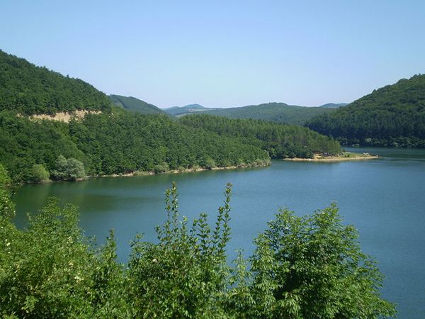 | ||
Batlava Lake (Albanian: Liqeni i Batllavës; Serbian: Батлавско језеро, Batlavsko jezero) refers to both a lake and resort located in Kosovo.
Contents
Map of Liqeni i Batllav%C3%ABs
History
The village of Batlava is inhabited by ethnic Albanians. The artificial was created during the communist era as a water supply source for the Pristina and Podujevo region.
Present day
Batlava Lake is the main source of potable water for the cities of Pristina and Podujevo. As a result of the cities' population growth, withdrawal regularly exceeds inflow, especially in summer.
Batlava Lake is a popular destination for locals. Thus, tourism is a large revenue source for the local village. The lake is in the Lab region and is fed by the Batlava River from the north. The village of Kolić is also located quite near the lake.